


This Google tutorial explains how to use My Maps to create a custom Google Map.
Excel use continues to grow by leaps and bounds. It proves to be an indispensable tool in the appraisal profession and the tax assessor’s office. Among the vast applications is its particular affinity for complex data management. Enter the laborious task of tracking income and expense data for commercial industrial property. This Excel demonstration will focus on the skill sets employed in processing income and expense information. Statistical analysis and development of income approaches will be the highlight of this session. Credits: 2 appraisal credits
Moderator: DENNIS DEKLERK, CTA
Speakers: Alex J. Worth, SLREA, CTA- alexjworth.com
Pamela J. Brodowski, MAI, ASA, CTA
BRB Valuation & Consulting Services
Eastampton, NJ 08060
(609) 261-4220
Fax: (609) 261-4244
pjbbrb [ at ] aol.com
 Excel Tips, Tricks and Shortcuts
Edutechional
Series: Become an Excel Master in Around 2 Hours
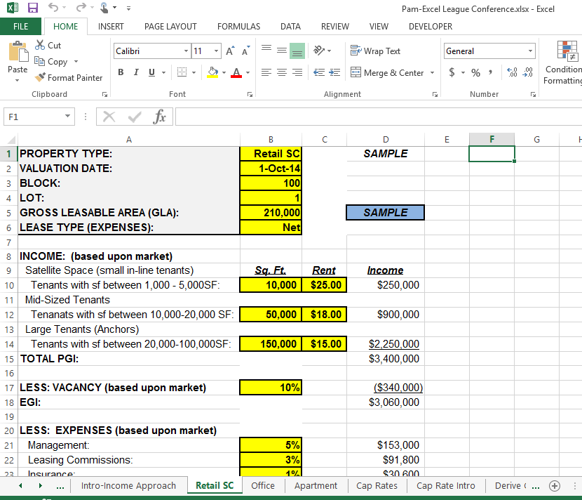
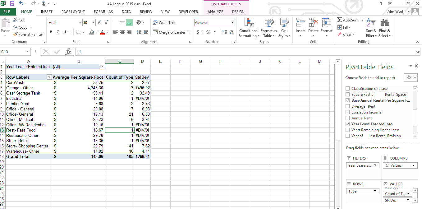
Utilizing Collected Data
To Formulate Market Indictors
1. Rents
2. Vacancy
3. Expenses
4. Capitalization Rates
For use in the Income Approach to Value
DOWNLOAD THE WORKBOOK HERE
Tables
-
Text Filters
-
Conditional Formatting
Text concatenation
=CONCATENATE(TRIM(A2),":",TRIM(B2),":",TRIM(C2),":")
=VLOOKUP
Looks in the first column of an array and moves across the row to return the value of a cell

KML for Sales Data
Download Google Earth Pro for PC or Mac
Note: Google Earth Pro requires a license key. If you do not have a key, use your email address and the key GEPFREE to sign in.
Link for FEMA Wetlands data
Link for FWS Wetlands & Riparian - U.S. Fish and Wildlife Service
Video Tutorials & Links
Adding legends, logos and banners to Google Earth with Screen Overlays
Click Here for how to create the code
Or Click here for the free KML Screen Overlay Maker Utility (select the "full packaged install")
Converting .SHP and other GIS file layer to KMZ
Click Here to download Ogr2gui, a simple software solution.
Overlaying Images Over Google Maps & Satellite Images Using Google Earth
Google Earth- Create a Project Path and Placemark
Tutorial on how to create a Google Fusion Table map visualization
Excel and mapping polygon
s
Excel and mapping with Fusion Tables
Learn Google Earth: Importing KML, KMZ and GPS Data